Transcription of the interview published by the news portal BELTA on 22 April 2019

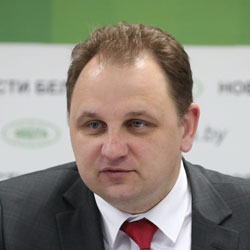
In 2018, the European Union launched the first Twinning project in the history of Belarus, aimed at strengthening the capacity of the National Bank. The second project is expected to start this year – this time the National Cadastre Agency (NCA) of the State Property Committee will receive the EU consulting assistance under the Twinning program. Andrei Filipenko, Director General of the NCA, told about the project in detail in an interview with BelTA correspondent, Tatiana Lisatovich .
– Andrey Alexandrovich, what is the project and why is a tool like Twinning chosen for its implementation?
-The project, which we are implementing with the support of the European Union in the framework of the Eastern Partnership initiative, will be aimed at strengthening the capacity of geospatial data management. This is a consulting project. The European Union will allocate about 1.2 million euros, which will be used to pay for the work of representatives of European companies. If we try to summarize the essence of the project, I will start with the fact that today the National Cadastral Agency mainly uses its spatial data. At the same time, there are a number of organizations and departments that also create similar content and publish it. But this layer is not connected with other data, so it is not so informative and interesting. We will offer such organizations to publish their data with us. In this case, we are not talking about the physical transfer of data or rights to them – they will simply be displayed on our public cadastral map, so that the user will see the full picture. Moreover, the map will show who owns the data. The second variant, which we will also offer to spatial data developers, will be suitable for those who do not have their own servers to store them or do not have developed software products for data publishing. In this situation we can act as a kind of storage chamber – to store this data and publish it. We believe that this scheme of interaction will be interesting for our partners and at the same time mutually beneficial. Why Twinning? First, let’s see what it is. Twinning is a form of cooperation between the public administrations of the European Union and their counterparts in the candidate countries and in the EU neighbourhood. Twinning projects contribute to public administration reform and develop European standards and norms. The key to the success of Twinning is to provide recommendations on an equal footing by EU civil servants working hand in hand with the national administrations in the partner countries. Typically, the programmes are implemented within a relatively short time frame (1-3 years) and are designed to achieve mandatory, pre-agreed results. We learned about this way of cooperation with the European Union from our colleagues from Germany. By that time we have already done a lot (not only NCA, but also other enterprises of the State Property Committee) in terms of collection and use of spatial data, and in the field of real estate registration Belarus has long been among the top ten countries in the world according to the World Bank Doing Business rating. At the same time, we at the NCA actively studied the world experience in order to manage large data even more effectively. We have started to study the experience of the countries, where similar projects have already been implemented, from Belarus. The National Bank was the first in our country to start implementing the Twinning project. Having talked to the members of the project team both from the Belarusian side and from the EU side, we were inspired by their results in a good way.
– Recently, your partners from the Netherlands and Spain came to Belarus to discuss the initial steps of the project.
– During this visit, we met personally with the colleagues we are to work with, exchanged basic information and determined the preliminary dates of the next working meeting. In addition, we have compiled the first edition of the list of interested government agencies and organizations, with which the National Cadastral Agency cooperates or will cooperate and which should be involved in the project implementation. After all, despite the fact that it is being done for the NCA, its meaning is to organize effective and trustworthy interaction with our partners. Perhaps, it is the main thing in the construction of spatial data infrastructure – to know the partners, their needs and be able to build interaction in such a way that each producer of spatial data could use not only its data, but also the data of its partners, and that this cooperation was economically and technologically beneficial to all participants.
– When do you plan to start practical implementation of the project?
– The project is designed for 24 months. Today, all our activities are focused on the works related to the registration of the contract with the Ministry of Economy. This is necessary to start the work. We very much hope that by June 1 of this year the project will be registered, and we will begin directly to its practical implementation. Now each of the parties ( Spain, the Netherlands and us) is actively preparing for the project so that after the registration of the project we can quickly get involved in the work. By the way, we believe that the Ministry of Economy will be able to become one of the most active and significant consumers of “interagency synthesis” of spatial data to achieve the Sustainable Development Goals, because it will be able to use them as a digital spatial basis for the preparation of system management solutions in the field of economics and modeling the consequences of their implementation. Also, the Ministry will be able to simultaneously visualize the spatial information of various existing and being developed state programs at the national and local levels, to conduct a more rapid and accurate analysis of this “layered information pie” for the mutual synergy of planned activities and consistency of the spatial component of state programs. It will also be able to compare initial data and planned results of various state programs with other legally significant spatial information from the state registers and registers.
– You said that the results of the Twinning project are to be agreed before the parties start implementing it. What results do you expect?
– We plan to obtain four main results from the project. Firstly, we will study the international experience of sharing spatial data, which are created by various government agencies and organizations. Proposals will be developed to build an business model for the use of spatial data, on activities aimed at expanding the practice of their use by citizens, the state and businesses. Secondly, we will study in more depth the spatial data and their flows: we will determine which organization creates what data, with what degree of accuracy, whether there are any disadvantages in them, or better to say – “growth areas” (perhaps, the data is not quite complete and up to date, somewhere the georeferencing is not quite accurate, etc.). If necessary, we will develop joint approaches and solutions to improve the quality of already existing spatial data (not to the ideal but to an acceptable state), we will prepare proposals on technological and administrative solutions to improve the quality of newly created spatial data. The third result is the increase of technical capabilities and technical potential of NCA as a provider of electronic services company, which provides the development of applications, data management and security. We, together with our foreign colleagues, will make an objective diagnosis of the digital infrastructure of the National Cadastre Agency and develop a business plan describing the strategic activities that the NCA must undertake in its new geospatial digital service provision model. In particular, with the participation of international experts, we will assess to what extent our proprietary software and the software we have developed ourselves meets modern and future requirements. Another result of our project is the development of human potential for the production, management and exchange of data. In cooperation with international experts, we will try to work out a strategy of continuous training or professional development of NCA employees and partner organizations, because in the modern world there is no completed education – people must constantly learn, improve their skills, because both technologies and consumer needs are developing very rapidly. On the way to achieving this result, we plan to raise to a new level and now generally good cooperation with universities. To invent new ways of their participation in practical work and thus constantly improve the quality of training of students, create conditions for the continuous professional development of teachers. We want to move away from the practice, which we often see now, when the first thing that the yesterday’s student hears when coming to his workplace: “Forget everything that you were taught at the university – everyone is not at work for a long time. We have to work with the universities involved in this project to come up with a way to make sure that the graduate is able to start practical work right away. Ideally, he or she will defend his or her term paper or diploma thesis based on the applied tasks solved at the production site. In addition, after the implementation of the project and activities, everyone will be able to get a convenient access to metadata (data). In other words, it will be possible to find out at one e-mail address what spatial data exist in the NCA and its partners, what is the quality (degree of accuracy) and relevance of these data, what organization created them and is responsible for their compliance with the requirements, who owns the rights to this data (with whom to negotiate access to them for viewing or uploading). And, of course, as a result of this project there will be even more spatial data in the public free access to the NCA cadastral map (map.nca.by) and other information resources of the agency.
And, as we believe, we are talking not only about the data produced by the National Cadastral Agency, but also about the data produced by other enterprises subordinated to the State Property Committee, other agencies (I think we will be able to agree with them on this), as well as data created as a result of volunteer movement (such as, for example, a layer of “springs” created on the public cadastral map for the Year of the Small Motherland). It is also planned to develop international cooperation on the sharing of spatial data, naturally, in compliance with the relevant requirements for information security. For example, it is possible that you and I will open an electronic map and move on it on the monitor screen from country to country, without noticing that we see spatial data of manufacturers of other countries, placed on other servers in other countries. In conclusion, I would like to note that the rational management of digital spatial data is the key to building an effective e-government. We expect that the results of this project will also help to prepare competent, modern and ambitious proposals for the next program of real estate registration system development for 2021-2025.
